IODP
Expedition 317: Canterbury Basin Sea Level
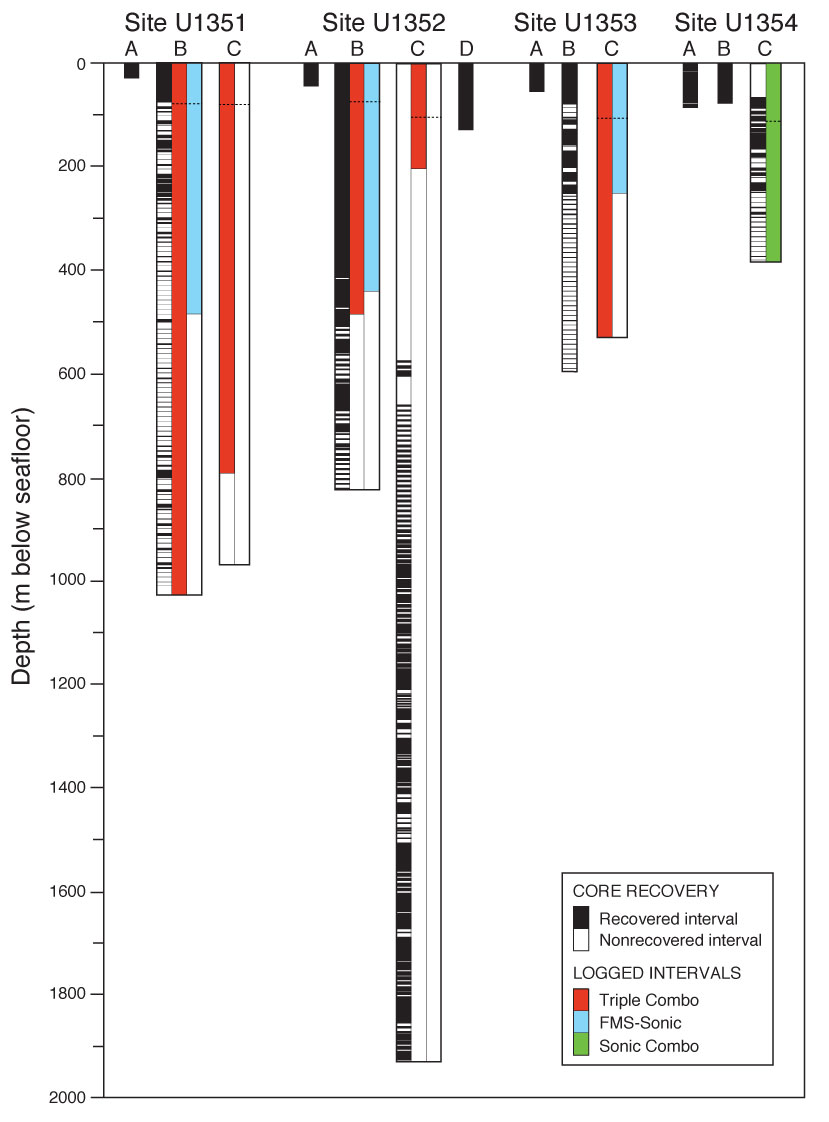
Figure
4
Logged intervals and tool strings run for each hole during Expedition 317. Intervals include logging through drill pipe between the seafloor and the drill bit, for which only gamma ray data is reliable. Pipe depth for each hole is indicated by horizontal dashed line.