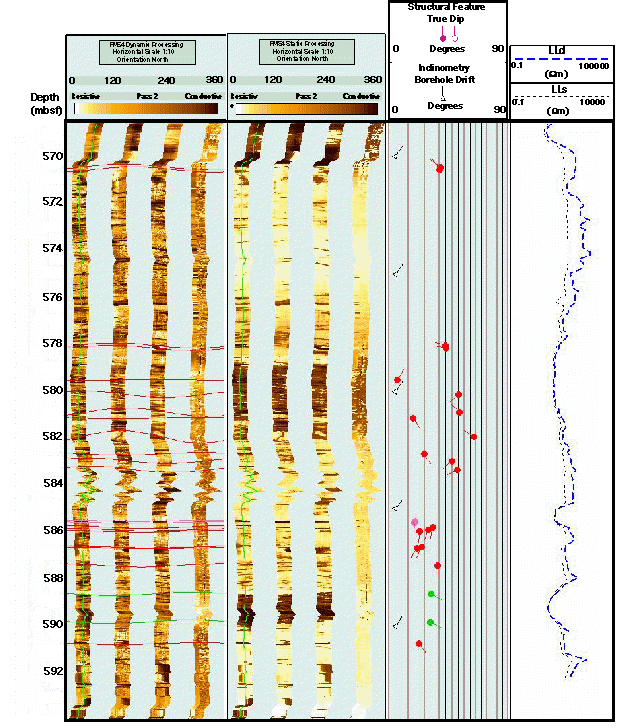
FMS image showing the bottom most 25 m logged interval that includes structural features and lithological boundaries.
This figure also includes a depth scale in mbsf; dynamic and static processed FMS images; borehole drift and structural dips and azimuth; deep and shallow resistivity logs from the DLL.